Mapping the Future Together: Esri and the National Geographic Society


The OER Observatory aggregates and displays OER-related news and content from third-party sources worldwide. This content is not produced by UNESCO or the OER Dynamic Coalition. All rights and responsibility for the original content remain with the respective authors and publishers. The inclusion of third-party content in the Observatory does not imply endorsement by UNESCO or the OER Dynamic Coalition. Users can access the original source through the link provided with each item.
Written by Dr. Deborah Grayson
As chief education and community engagement officer, Deborah Grayson furthers the Society's mission to illuminate and protect the wonder of our world by amplifying and extending the work of National Geographic Explorers into classrooms and communities.
This article is part one of a three-part series highlighting new resources for educators this school year.
I've always believed that a great map tells a story about people and patterns, and geography. That is why I am so excited by what we are building with Esri. By combining National Geographic's storytelling and education expertise with Esri's powerful mapping technology, we are helping learners see their world in entirely new ways through National Geographic MapMaker. We have reached some incredible milestones this year, and I cannot wait to share a few of my favorite updates with you as we start a new school year.
Growing MapMaker Around the World
National Geographic MapMaker is where exploration happens. This interactive tool gives students and educators an easy way to explore geographical data and tell compelling stories. As middle school teacher and Grosvenor Teacher Fellow alumna Allison Fuisz describes it, "it's a catalyst for curiosity." Our free, web-based mapping tool lets students layer data, sketch on maps, and move between a flat map and a 3D globe, all without needing any prior GIS experience.
"MapMaker allows [students] to build appreciation for what they see around them in nature... If they're using this technology to explore, they're going to hopefully look for that outside." - Allison Fuisz
Since launching in 2023, MapMaker has received more than 5 million views -- a milestone that speaks to how many teachers and students have made it part of how they explore the world. And that reach keeps expanding: MapMaker is now growing internationally through our collaboration with Esri Distributors. The digital experience has been expanded to fit curricula in new countries around the world, including the United Kingdom, Netherlands, Colombia and Ecuador, with Jamaica (in collaboration with Spatial Innovisions) and Panama coming soon.
Guided Lessons
The National Geographic Society, Esri and National Geographic Learning/Cengage have teamed up to help promote geographic thinking by developing collections of guided lessons that make it easy to integrate mapping activities into classroom activities.
* The Earth Science collection gives students the data to trace why earthquakes, volcanoes, and rivers show up exactly where they do.
* The World Cultures and Geography collection helps them investigate why the world's cultures take the shape they do -- how trade routes connect people, how communities grow and settle, and how cultural diffusion spreads ideas.
* And with the semiquincentennial anniversary of the United States this year, the new America 250 collection invites students to dig into why the United States looks the way it does today, and how it compares to 250 years ago.
Developing New Ways to Support Educators
As MapMaker and its resources have grown, we wanted to better support educators in using these tools and to help them save planning time. With Esri, we built a new MapMaker Support Hub, so teachers can find answers, best practices, and the latest lesson updates, all in one place. There is also a comprehensive library of short videos to demonstrate how to use all of MapMaker's dynamic features.
Additionally, we're introducing a Support Hub AI assistant, Vera, that is designed specifically for teaching planning and requires no login and is anonymous. It can help teachers to create a lesson with MapMaker. Educators can ask Vera to discover maps, layers and resources, to suggest maps for curricula, or to produce guiding questions and quizzes.
National Geographic MapMaker Arrives at the Museum of Exploration
MapMaker comes to life in a new way at the National Geographic Museum of Exploration. The National Geographic MapMaker kiosks are a centerpiece of the National Geographic Learning Launchpad, powered by Cengage. These interactive kiosks allow students to investigate complex geographic questions using the same data sets used by National Geographic Explorers.
The built-in prompts and guiding questions have been helping visitors see how people and nature are closely connected, both in their own neighborhoods and around the world. This data then becomes a powerful tool for understanding our impact on the planet.
Taking the Stage at the Esri User Conference
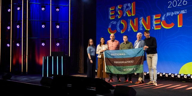
This July, our partnership with Esri took center stage at the Esri User Conference in San Diego, the largest annual gathering of the GIS community, with more than 18,000 attendees from over 100 countries. During the Plenary Session, Esri president Jack Dangermond named the National Geographic Society as Esri's strategic partner in education, celebrating a shared commitment to advancing geographic literacy and GIS skills. His mainstage conversation with our CEO, Jill Tiefenthaler, demonstrated the impact of MapMaker to thousands of GIS professionals, extending its reach well beyond the classroom.
The conference also gave us a chance to celebrate some of the young people building GIS skills of their own. Five alumni of the jointly-run National Geographic Society and The Nature Conservancy Externship program attended, with two presenting their own work in conference sessions and another speaking on the Esri Education Summit's plenary stage.
Every one of these achievements reflects the same goal: giving learners of all ages the tools to understand and explore their world. It's a goal that our partnership with Esri is making easier and more accessible for educators and learners everywhere. In part two of our Back to School series look for what Education has been doing with EduHub, Explorer Classroom, and Open Educational Resources.